This loop, the Waterfall loop, is just that, a loop encompassing the waterfalls in Cedar Run and White Oak Canyon. The sheer amount of waterfalls and beauty attracts A Lot of tourists, particularly White Oak Canyon. It is by no means a very difficult loop, but it does offer up a lot of very technical trail. It is the one of the shortest loops in this series of runs, but it offers almost an unbeatable amount of technical trail for the area. It is a nice introductory loop to the area, and can accompany a short run stopping at the falls for views, or for a short day hike.
It starts at the trailhead in White Oak Canyon, with an official start at the trailsign at the edge of the parking lot. From there one takes the trail for ~0.1mi and takes at a left onto Cedar Run trail, with its junction with White Oak Canyon Trail, marked by the cement sign post. From there one follows Cedar Run trail for 2.8mi. The trail follows Cedar Run up, offering views of many waterfalls and rapids. The trail itself starts gradual, then steepens (up to 40%), then grades off again, with the upper 4/5 being super technical, marked by extremely poor footing mainly due to a bed of rocks offering no sure footing (particularly if one is descending).
Just before reaching Skyline Drive, the loop takes a right on an unnamed Horse Trail marked by a cement post (it is the only trail junction on the trails entire length). The horse trail meanders up and down for 0.6mi, with lots of rock (no surprise) but still allows one to run fast. Soon, the horse trail dead ends at White Oak Canyon forest rd, which it descends all the way down 1.6mi until it reaches White Oak Canyon. This is the only stretch of trail that is entirely rockless, and is a great spot to let the legs run free if their itching to roll over. At the end of the forest rd, one must cross Robinson River (there is a bridge about 75yrds upstream if you prefer not to get your feet wet, it is possible to hop across on rocks when the river is not swollen). I find it more fun to just wade across, when it's warm that is!
Once across, hang a right and start to descend White Oak Canyon Trail. Now, White Oak Canyon trail offers unbeatable views of many many many waterfalls, for which it offers lots and lots and lots of rocks and techy trail to compensate for the splendid views. But, it is faster to descend White Oak Canyon than it is Cedar Run, mainly due to the nature of the rocks. The rocks in Cedar run are mostly baseball to basketball size, with the very frequent large step and boulder present, but White Oak Canyon consists of mostly larger rocks which offer a bit more foot certainty and allows one to descend a bit quicker. Both are extremely technical regardless, but both are definitely fun. White Oak Canyon gradually steepens (up to ~36%), for ~1.5mi with the last ~0.8mi becoming much more gradual and flat, and a teeny bit less rocky. It then hits the trail junction with Cedar Run, with the cement post, and it is ~0.1mi back to the trailhead.
Route Totals (mapped with a Suunto Ambit)
7.6mi
2,600' (+ elevation gain)
For those setting a barometer TH elevation is 1,115'.
Coordinates of TH -- for google maps, gps, etc (38.539482, -78.349176)
Mapset & Data
This route is quite simple to follow, but, for those wanting to carry/preview a mapset & data table:
Downloadable Mapset for SNP: Waterfall Loop (NatGeo labeled with POI)
Downloadable Data Table for SNP: Waterfall Loop (including mileage, elevation, pts of interest, jcts, etc)
All Pics below taken on 4/22.
.jpg) |
| Waterfall Loop overview map (CW). |
 |
| Produced in GoogleEarth. 2,600' of vert. |
 |
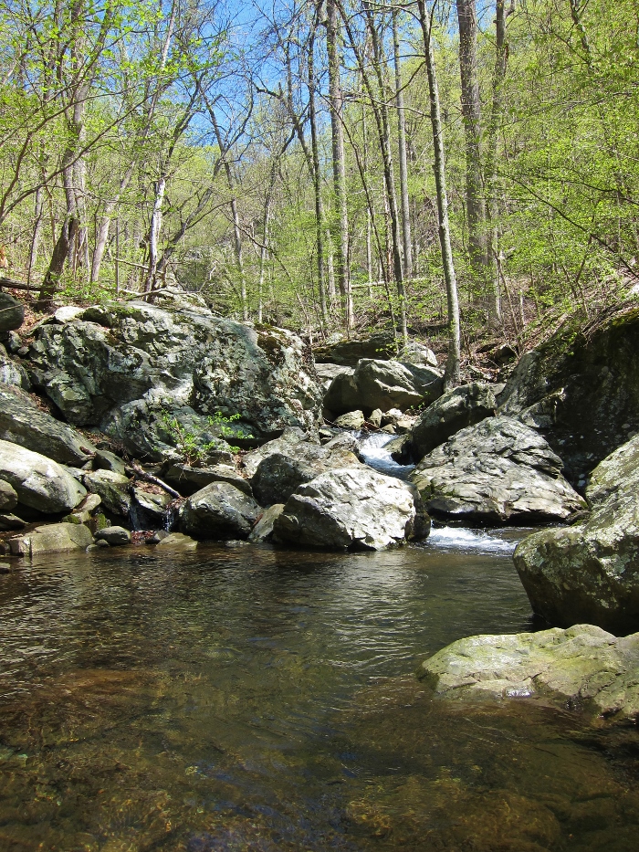
| Lower falls on Cedar Run. |
 |
| Looking downstream at the lower falls crossing on Cedar Run. |
 |
| One of the only smoother stretches along Cedar Run. |
 |
| The Slide on Cedar Run. |
 |
| Start of some rock-stairs on Cedar Run Trail. |
 |
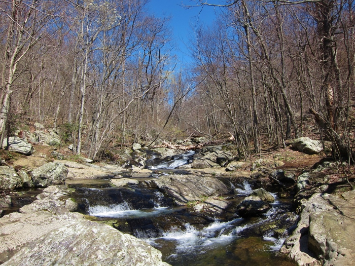
| Upper Falls on Cedar Run. |
 |
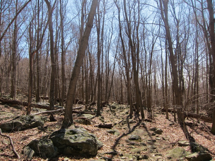
| Typical stretch of trail on upper Cedar Run. |
 |
| Rocky tread on the 'Horse-Path'. |
 |
| Crossing of the Robinson above the Upper Falls on White Oak Canyon, at the base of the forest rd. |
 |
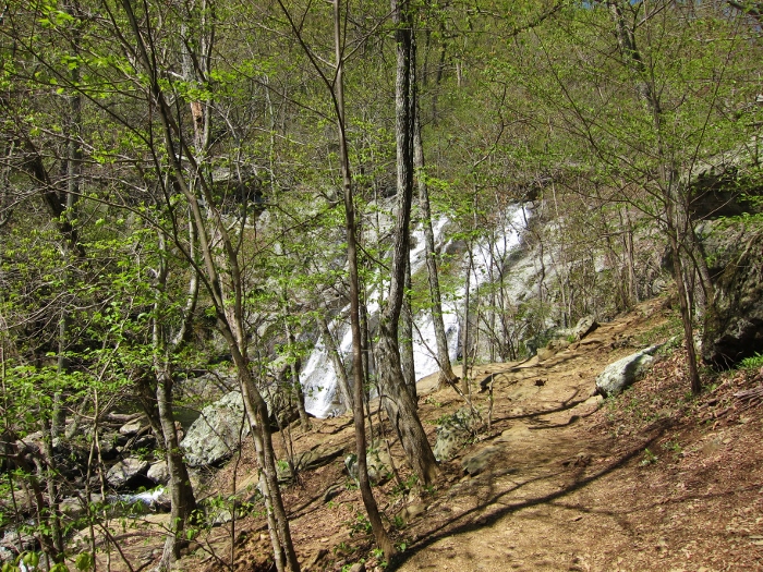
| Upper falls in White Oak Canyon, absolutely stellar. |
 |
| More falls along White Oak Canyon. |
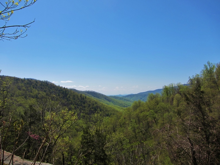 |
| The only vista along the route, overlooking White Oak Canyon. |
 |
| Fun |
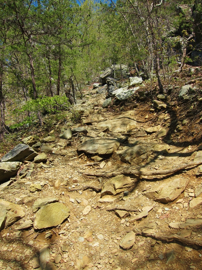 |
| One of the steeper and more technical stretches along White Oak Canyon. |
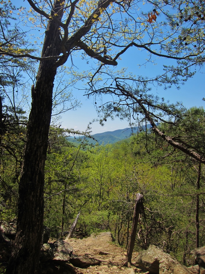 |
| Looking down steep grade in White Oak Canyon, overlooking the canyon beyond. |
 |
| Some of the gnar in White Oak Canyon. |
 |
| More beautiful falls in White Oak Canyon. |
 |
| Overlooking the Robinson. |
 |
| The lower falls in White Oak Canyon, |
 |
| Even more falls in White Oak Canyon, plenty of opportunities to take a dip on a hot day. |
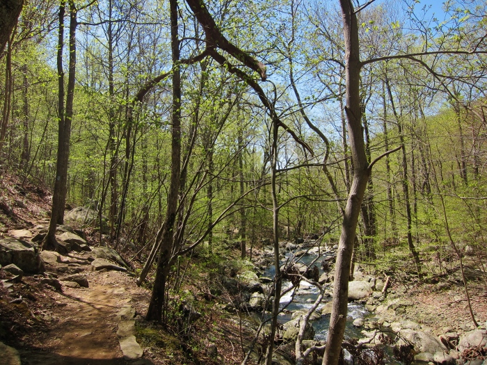 |
| Trail paralleling the Robinson in lower White Oak Canyon. |
 |
| Cruising |
 |
| Last crossing of the Robinson right before the trailhead. |


.jpg)


